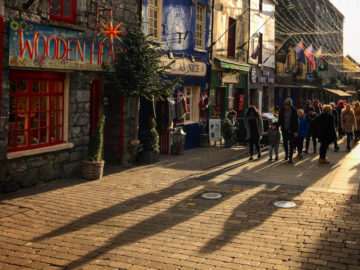
Best Walks in Galway
There’s nothing quite like being out in the great wide open, and to say Galway is a walker’s paradise is a bit of an understatement! With spectacular mountain ranges, fine beaches and stunning scenery around every corner, Galway is a natural centre for walking and hiking. And with such a variety of landscapes, thousands flock to Galway each year on walking holidays. Clean fresh air, plenty of exercise in beautiful surroundings, what more could you ask for? See also the best family friendly forest walks in Galway 🌳.
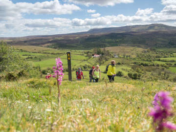
Best Hill Walks in Galway 🌄
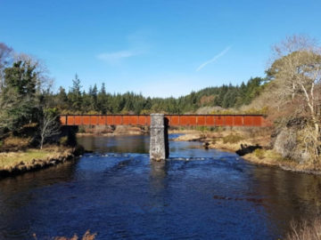
Western Way
This 53km route starts at Oughterard and finishes at Leenane. On route you’ll also take in Maam, Maumeen, Inagh and Toorenacoona, as well as the Maumturks, the Twelve Bens, and the banks of Lough Corrib. The terrain consists of quiet roads, bog roads, open moorland, forestry tracks, mountain paths and about 3km of timber bog bridge: some parts of the route can be very wet and boggy, particularly after a rainy period, when there is a fast run-off from the Connemara mountains.
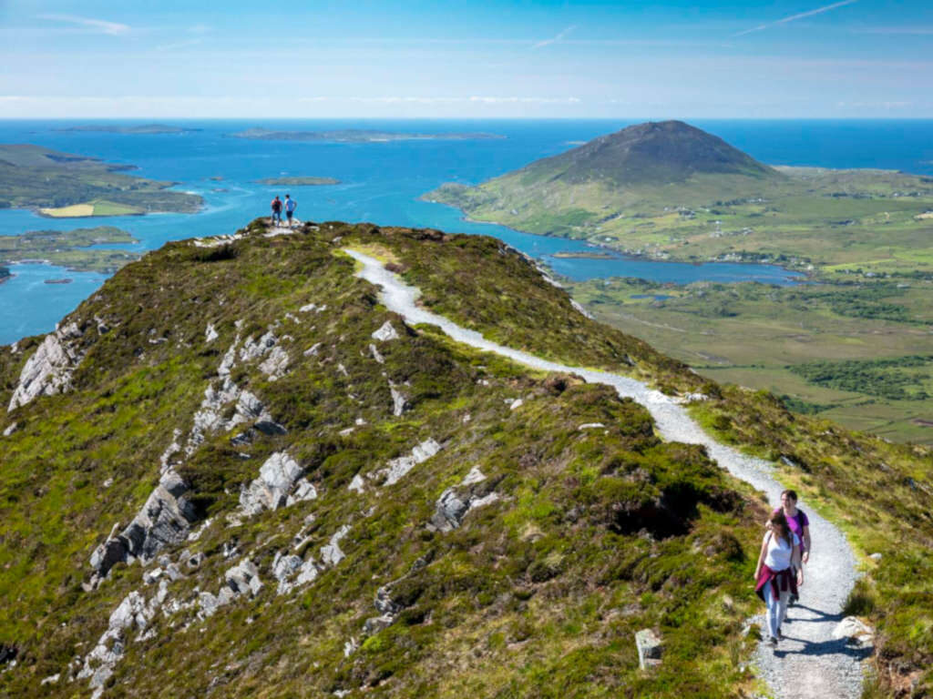
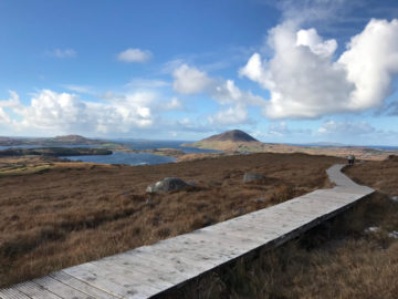
Diamond Hill in Connemara National Park
Spanning nearly 3,000 hectares of mountains, bogs, heaths and woodlands, Connemara National Park is a fantastic spot for walking and hiking There are actually 4 looped walks to do within the park over and around Diamond Hill – Ellis Wood Nature Trail (0.5km), Sruffaunboy Walk (1.5km), Lower Diamond Hill Walk (3kms) and Upper Diamond Hill Walk (3.7kms). The pathways are well marked out and signposted and the walks are planned to suit everyone, from the novice to the well-seasoned walker. Expect amazing coastal and mountains views throughout. You also have the added comfort of having Park Rangers on hand, just in case you get into any difficulties.
Errisbeg Hike
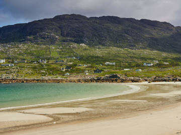
The Errisbeg hill route, starting in Roundstone village to Errisbeg Hill (300m), is a moderate and enjoyable hike for all ages with only some previous experience of hill walking needed. Take the narrow road close to O’Dowd’s Restaurant and follow the road towards Errisbeg for approx 2km. Traverse the gate at the end of this road to start the ascent of the hill. Veering left choose your route uphill following sheep tracks while avoiding boggy section and streams. Aim for the cairn (mound of rough stones) at the top. Once you reach the summit you’ll be rewarded with spectacular views along the coast including the amazing tombolo beaches of Gurteen and Dog’s Bay.
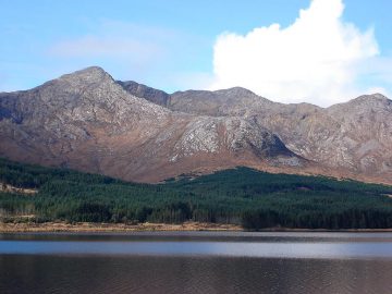
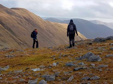
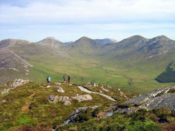
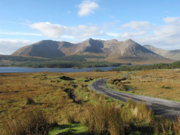
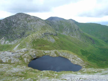
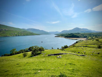
Maumahoge Lake in The Maumturks
The Maumturks mountain range is also located in Connemara with its highest peak rising to 703 metres. The mountains run from Maam Cross to Leenane. Our recommended walk features the stunning mountain saddle corrie lake of Maumahoge, which includes a beautiful stream with waterfall and glorious views of both the Maumturk and Twelve Bens peaks and the Inagh Valley below. The walk begins where you can find parking on the road to the car park of the Holy Shrine of Máméan (GPS: 53.5109289, -9.707427963). This up and back route involves steep open hillside, bog and rock over a distance of approx 6km and a 450m total ascent which is rewarded at the top by the wonderful glacial feature of the corrie lake of Maumahoge. Ensure you have good mountain gear and be aware of steep sides and cliff ravines.
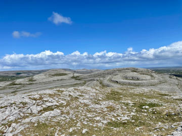
Mullaghmore in The Burren
Although in The Burren, Co. Clare, the Mullaghmore Loop is a similar distance from Galway City as most Connemara trails and is a must for all walkers visiting the west of Ireland. This exceptional route has breathtaking views from start to finish and exhibits the finest features of The Burren. Discover unusual and rare specimens of flora (wild orchids, spring gentian, mountain avens, shrubby cinquefoil and bloody cranesbill) and fauna (Peregrine Falcons, Slow Worm, Lesser Horseshoe Bat and Pine Martens), interesting geological formations and ancient fossils along the well marked trails. From the car park at Mullaghmore Crossroad, the route follows the green road, part of the Burren Way. Then 1.5km along take a left as signposted through one of the many hazel wood sections where spectacular views of the Burren open up before you. Walk along the southern shore of Lough Gealain with its vivid green and blue waters, towards Mullaghmore and its distinctive limestone layers. As you reach the top, keep an eye out for Fr. Ted’s House, visible in the distance at Kilnaboy.
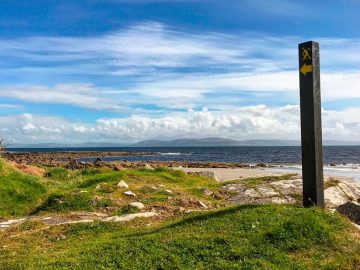
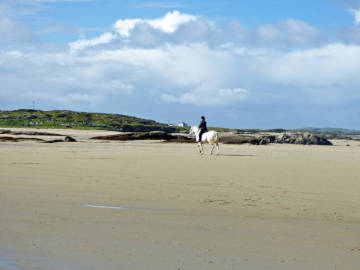
Best Coastal Walks in Galway 🌊
Inishbofin Westquarter Loop
Inishbofin has three looped walks, (Cloonamore Loop, Middlequarter Loop and Westquarter Loop) but the Westquarter Loop is the longest at over 8km. The Westquarter hike has an abundance of interesting features to explore from the ruins of a historic fort, the stunning views of the Dún More Cliffs, blow holes, sea caves and arches, the stone beach of Loch Bofin and dramatic coastal scenery of an island continually battered and shaped by the Atlantic Ocean. Head west from the main pier along the coast and follow the track marked by purple arrows on white backgrounds. The trail winds over grass paths, minor roads, old bog tracks and shingle beaches, with views of Inishark Island in the distance.
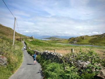
Omey Island Walk
The best way to explore Omey Island is on foot with a moderate looped walk around the island. Firstly you’ll need to access the island by traversing the tidal strand between Claddaghduff and Omey. As Omey is a tidal island it can be accessed by walking across, 2 hours before low tide to 2 hours before high tide. This will give you about 4 hours which is more than enough time to explore the island and return to the mainland. When you reach Omey follow the coastline around to the right, taking the route along the beach not inland. You’ll come to a sand path above the shoreline which leads northwards. You’ll traverse two beaches and look for a point where the fence line turns inland at the back of the second beach. This will lead to the ruins of Teampal Feichin, a medieval granite church dedicated to St. Feichin. Head back to the beach and proceed to follow the shore where you’ll reach the island’s northwest corner, and will see another small tidal island to the west named ‘Cruagh Island’. Cross the beach, taking the road passing two mobile homes and veer left, past the lake and returning down to Omey Strand.
Killary Harbour Coastal Walk
The Killary Coastal Looped Walk starts and ends at Tullyconor, where the N59 and the road to Bunowen meet. Firstly take the old famine road running along the southern shores of Killary fjord as far as Killary Harbour Hostel where you turn back around on lower road. This road provides wonderful views as you take in Lough Muck and Lough Fee to complete the loop.
Map of Best Hill & Coastal Walks
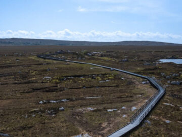
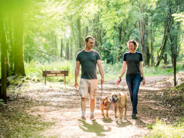
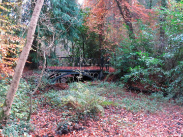
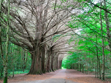
The Best Woodland Trails in Galway 🌳
Portumna Forest Walk
Portumna Forest Park provides walking options suitable for all the family. There is a choice of trails in the forest park allowing for short or longer walks with most starting and finishing at the library car park. The longer waymarked trails (Bonaveen Cycling and Walking Trail and Rinmaher Walking Trail) take about 4 hours to complete on foot. The generally moderate trails are over flat forest road and track and along walker friendly, purpose built timber boardwalks. Sections of the trails take in views of Lough Derg, its islands and out towards Terryglass. This section is a reserve for water fowl such as mute swan, duck, waterhen and cranes. Be on the lookout for the large herd of fallow deer roaming in the forest, pigmy shrews, otters, pine martens, red squirrel, stoat, badger and fox. Portumna Forest Park a mixture of native trees such as oak, ash and alder along with the non-native Scots Pine, Monterey Pines and Monterey Cypress’ and makes for one of the best woodland walks in Ireland. Download your Portumna Woodland Flora Guide here (© VisitPortumna.com)
Knockma Hill
If nothing else, this walk will awaken your curiosity – to see if you could find the burial site of Queen Maeve of Connaught. The famous Queen is supposed to be buried on top of Knockma Hill. This partially wooded hill contains examples of the famous Burren flora, the Spring Gentian and the Purple Helleborine to name but two species. From the summit of Knockma may be obtained one of the grandest panoramic views in Ireland. This walk starts at the car park in Castlehackett with a 4 km loop up and around the Knockma Hill, with glorious views of the lowlands of east Galway below.
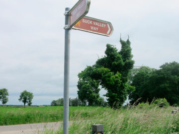
Suck Valley Way
The Suck Valley Way is a 105km walk starting and finishing in Ballygar County Galway that will take you through boglands, lowland farms, and the “9 friendly villages” Ballygar, Creggs, Glinsk, Ballymoe, Ballintober, Dunamon, Castlecoote, Athleague and Mount Talbot. The area is also rich in history, and offers an almost unique opportunity to experience the life of rural Ireland, a glimpse of its history and the rich bird and plantlife of the boglands and callows. It’s a marked walkway, just look out for black posts with yellow direction arrows.
Mountbellew Woodland
The trail at Mountbellew Woodland, a 5km walk, isn’t too hard on the legs. Look out for Sika deer, along with a museum that used to be a forge, a tug boat (around 900 years old), the Herd’s House and a flour mill (now in ruins), and magnificent oaks, sitkas and Norway spruces. The River Shevin flows through the area and an artificial lake adds to the beauty of the woodlands.
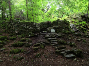
Coole Park Forest Walk
Coole Park outside Gort in Co. Galway was the home of Lady Augusta Gregory, dramatist and co-founder with Edward Martyn and W.B. Years of the Abbey Theatre. The area is also a National Nature Reserve due to its great wildlife importance – its native woodlands and turloughs. There are 2 waymarked trails around Coole Park to explore, the easy 1.75km ‘Family Trail’ and the longer 4.5km ‘Seven Woods Trail’ is a 4.5km walk connecting 7 woodlands brought to prominence by poetry by W.B.Yeats. The ‘Family Trail’ passes the site of Lady Gregory’s estate house and winds it’s way through the walled garden where you’ll find the famed Autograph Tree, bearing the inscriptions of many famous writers who visited Coole when Lady Gregory lived here. Kids will enjoy the extensive lawns and trees of every variety. Also on route are the Coole Interpretative Centre and the Red Deer enclosure.
The ‘Seven Woods Trail’ takes in the viewing point for Coole Lake turlough and broader wetland area, then leads deep into the woods where you’ll pass the remains of the historic ruins of Coole of the stable yard, the limekiln and the stone walls of the park first built in the 18th century.
The Hymany Way
The Hymany Way walking trail traverses the countryside of south and east County Galway for 80 kilometers from Portumna to Ballygar and forms the longest section of the Beara-Briefne Way from Cork to Leitrim. This primarily off-road waymarked trail follows the River Shannon, Ireland’s longest river for a time, passing through woodlands, bogs and wetlands. The area is home to a variety of protected bird species including Skylarks, Meadow Pipits, Sedge Warblers and The Corncrake. Along the route there are interesting ruins and historical places including the Battle of Aughrim Interpretative Centre, Brackloon Castle, Cloonigny Castle with nearby ringfort and the wonderful stone carved entrance to Clonfert Cathedral.
Map of Best Forest Walks
Walks in Galway FAQs
What are the easiest mountains to climb in Galway?
- Diamond Hill (6.7km / 3 hours)
- The Errisbeg Hill Walk (7km / 3 hours)
- Lackavrea Mountain (4.7km / 2.3 hours)
- Máméan Pilgrimage Walk (3.5km / 1.5 hours)
What are the best walks near Galway City?
- Barna Woods Walk (4km / 1.1 hours)
- Rinville Park Loop (5km / 1.5 hours)
- River Corrib Walk – City Centre to Dangan Sportsgrounds (6km / 1.5 hours)
- Claddagh to Blackrock Diving Tower (6km / 1.2 hours)
- The Western Way – Oughterard section (24km / 6 – 8 hours)
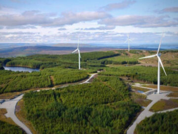
What walking trails are at Galway Wind Park?
Galway Wind Way consists of 6 walking and biking trails at Galway Wind Park near Oughterard in Co. Galway. The trails total 48km and offer a great choice of routes for people of all abilities.
- Peak Ridge Path (5.5km / 1.15 hours)
- Connemara View Loop Trail (5km / 1.1 hours)
- The Turbine Trail (5km / 1.2 hours)
- Seecon Lough Path (10km / 2.5 hours)
- The Forest Cycleway (21km / 4.5 hours)