The Hymany Way
A long-distance walking trail in South East Galway
| The Hymany Way Guide |
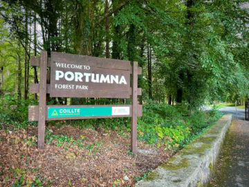
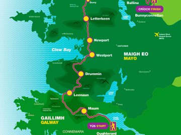
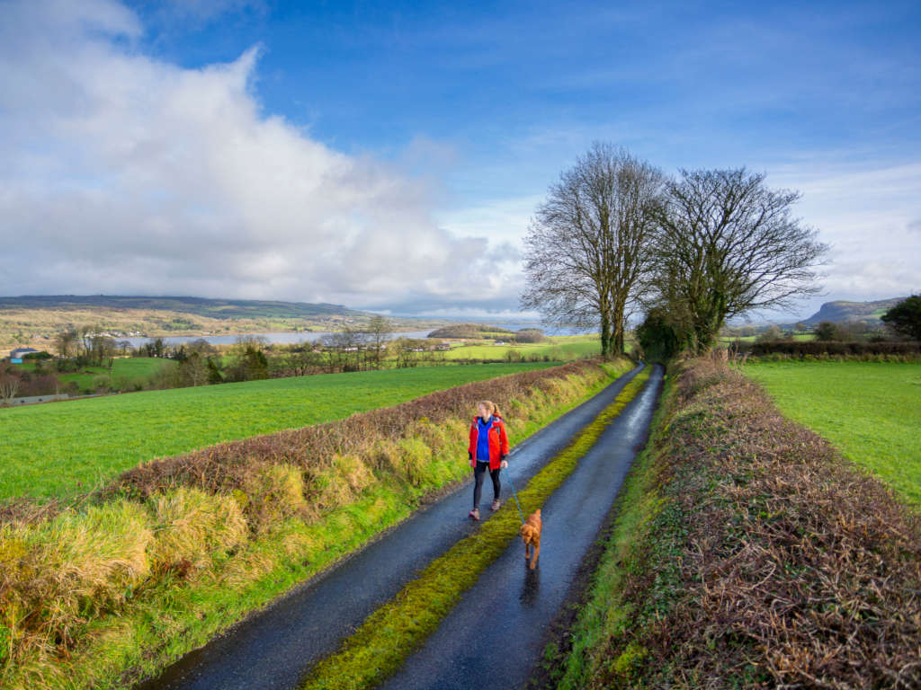
In the south east of County Galway on the banks of the River Shannon where it flows into Lough Derg you’ll find the scenic town of Portumna. This marks the starting point of the Hymany Way, a 80km mostly off-road hiking route which winds its way through idyllic pastoral land all the way to Ballygar, to the east of Galway City.
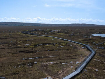
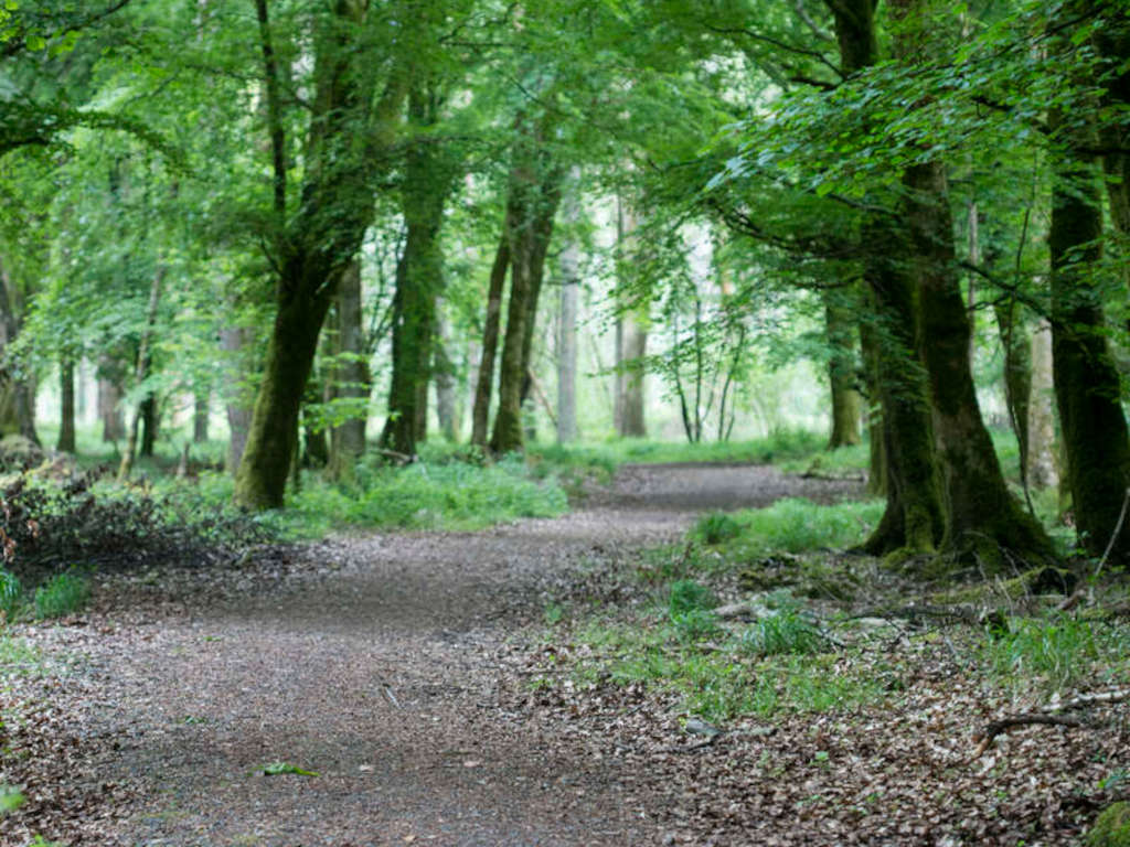
The Hymany Way crosses the open plains of this regions, watercourses, including the Shannon’s subsidiaries, through farmland, and beside the bogs that are so famous in the Irish midlands.
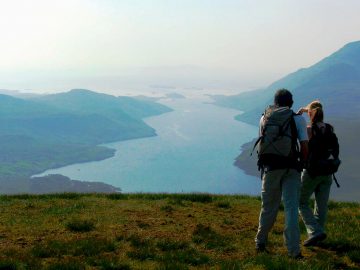
There’s an abundance of vibrant plant life and animals to peak your interest along the way, as well as the occasional boat or two cruising beside you on the river.
Highlights to see on The Hymany walk include:
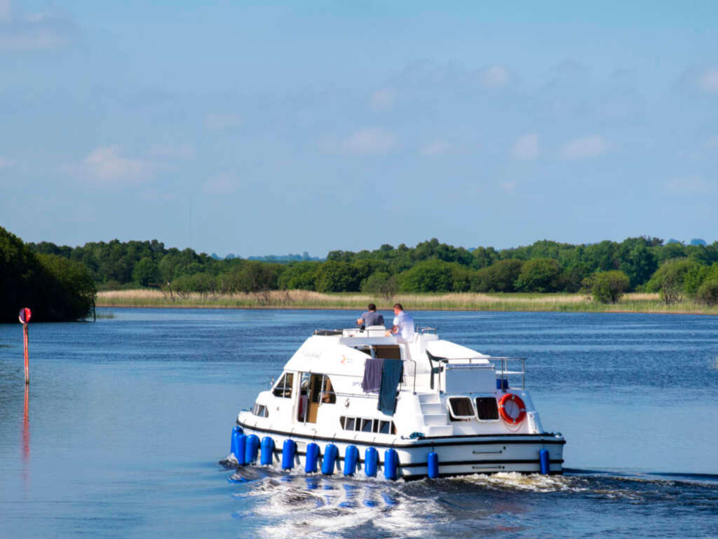
- Watch the boats cruise by at Portumna Bridge, a five-span pivoting bridge over the Shannon which is opens at fixed times to allow boats to pass through towards Lough Derg.
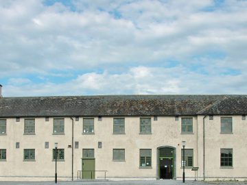
- Discover Meelick Church, the oldest Catholic church in Ireland that is still in regular use.
- Pass by Brackloon Castle, a 500 year old tower house and one of the smallest castles in Ireland still being inhabited today.
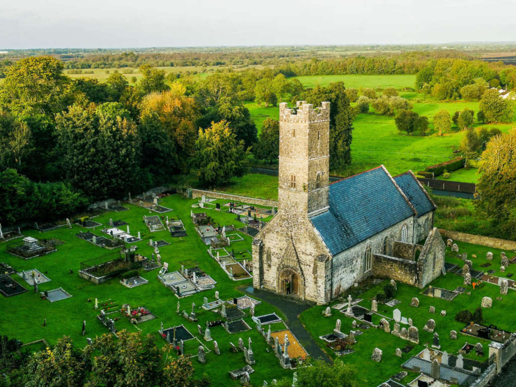
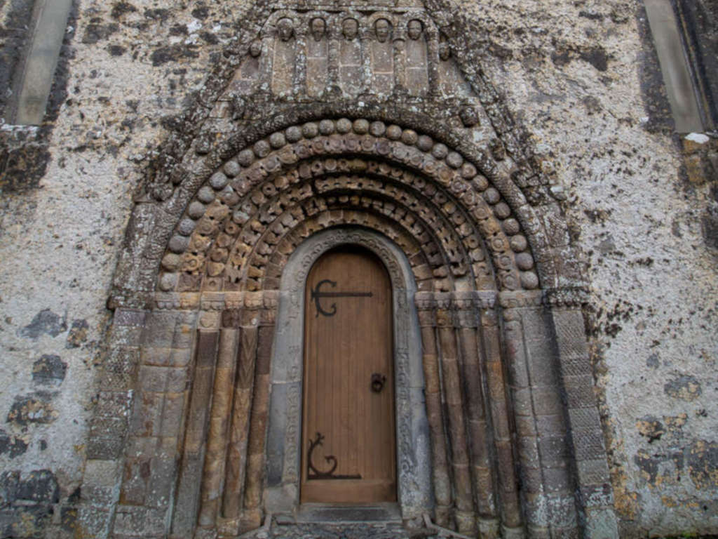
- Visit Clonfert Cathedral and examine the 12th century decorative stone-carved doorway, the 15th century stone carved font and the 19th century carved oak pulpit.
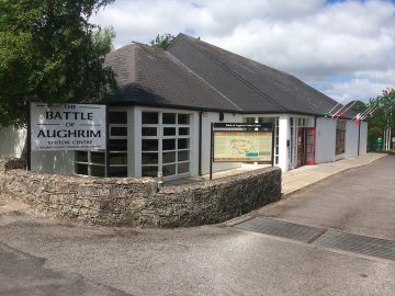
- The location of the Battle of Aughrim in 1691 and Aughrim Interpretative Centre
The Hymany Way route
What to expect on The Hymany Way
Points to Note
Distance: 80km / 49.7 miles
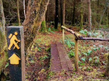
Waymarked: Yes
Difficulty: Easy
Trail type: Point to Point
Elevation: 91m / 325ft
Duration: 4 days approx
Reference map: OSI Discovery Series – 40, 4
Part of the greater Beara Breifne Way
The Hymany Way forms one part of a sequence of eleven sections of the much larger Beara Breifne Way, Ireland’s longest national waymarked trail. At over 500km, the route stretches from the southernmost point of Beara Peninsula at Dursey, Co. Cork northwards to the Breifne area of Co Leitrim.
Hymany Way FAQs
What is The Hymany Way walk in Galway?
The Hymany Way walk is a moderate-grade hiking trail that spans 90 km of lush landscapes of East Galway. Designed for walkers seeking a moderate challenge, this linear route takes approximately 3.75 days to complete, offering a perfect balance of exploration and immersion in nature.
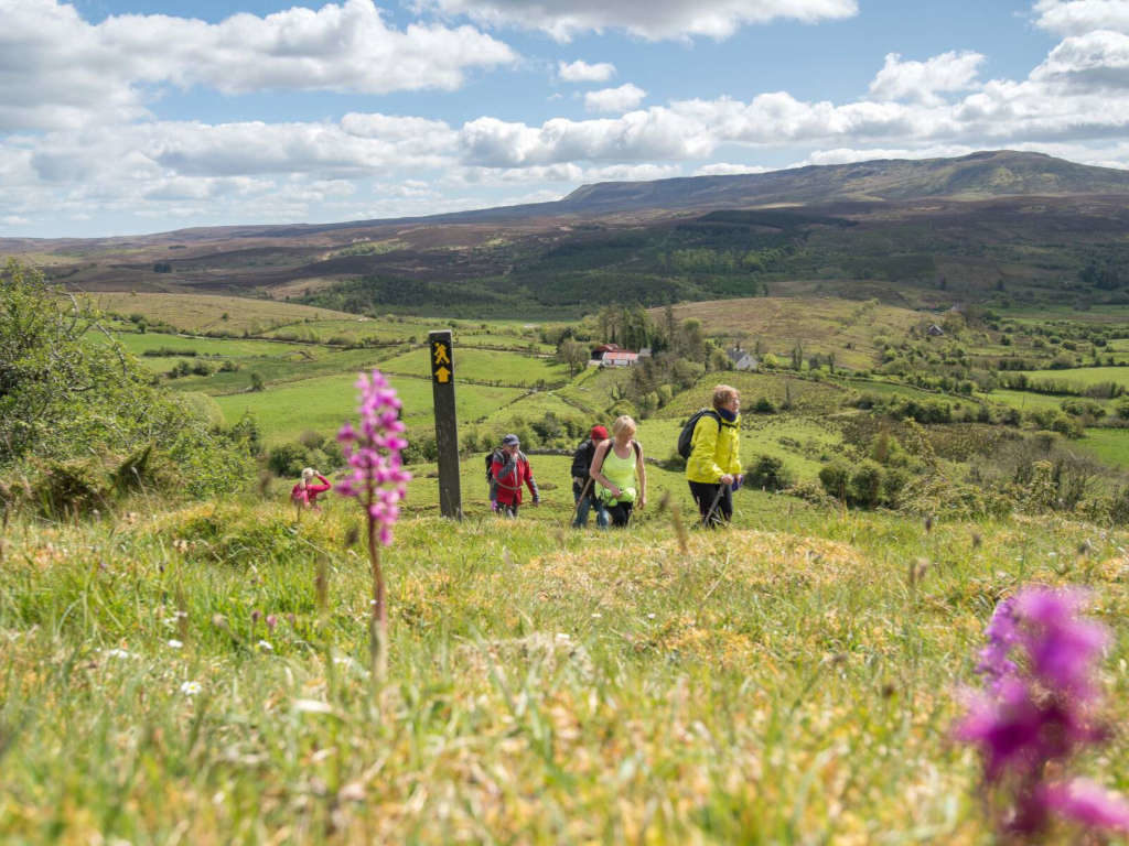
Setting off from the historic Portumna Bridge, hikers are greeted by the iconic yellow arrow on a black background waymarking, guiding them along the trail’s path. As they traverse through picturesque countryside, from rolling hills to serene lakeshores, each step unveils a new vista of Galway’s natural splendor.
The Hymany Way isn’t just a trek; it’s an opportunity to immerse oneself in the rich history and culture of the region. Passing through quaint villages and historic sites, it provides the opportunity to connect with the heart and soul of rural Ireland. Though dogs are not allowed, the camaraderie of fellow hikers and the sense of achievement upon reaching the finish point in Ballygar make every step worthwhile.
What are the stages of the Hymany Way walking trail?
Distance: 17.2 kmStage 2: Meelick to Clonfert
Distance: 7.4 kmStage 3: Clonfert to Ballinasloe
Distance: 21 km
Stage 4: Ballinasloe to Aughrim
Distance: 13 km
Stage 5: Aughrim to Ballygar
Distance: Trail officially ends in Ballygar
Additional Stage: Ballygar to Ahascragh
Distance: 18.9 km