The Partry Mountains
Enjoy stunning views of Connemara & Lough Mask
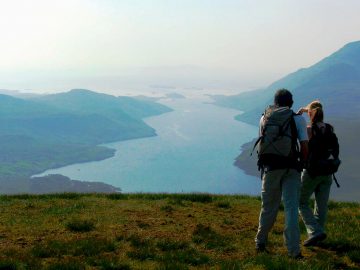
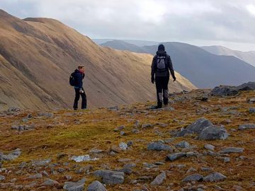
The Partry Mountains are a popular destination for hiking, hillwalking, and mountaineering but are the least visited of the famous mountain ranges that encircle Killary Harbour, Ireland’s only fjord. There are a number of trails in the range, ranging from easy to challenging and hillwalkers will be rewarded with stunning views of the surrounding countryside.
A wilderness with stunning unspoiled scenery
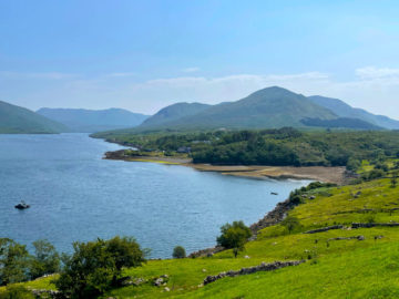
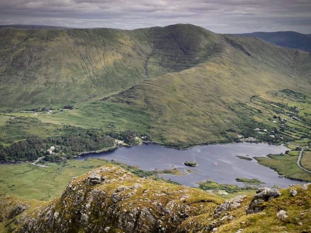
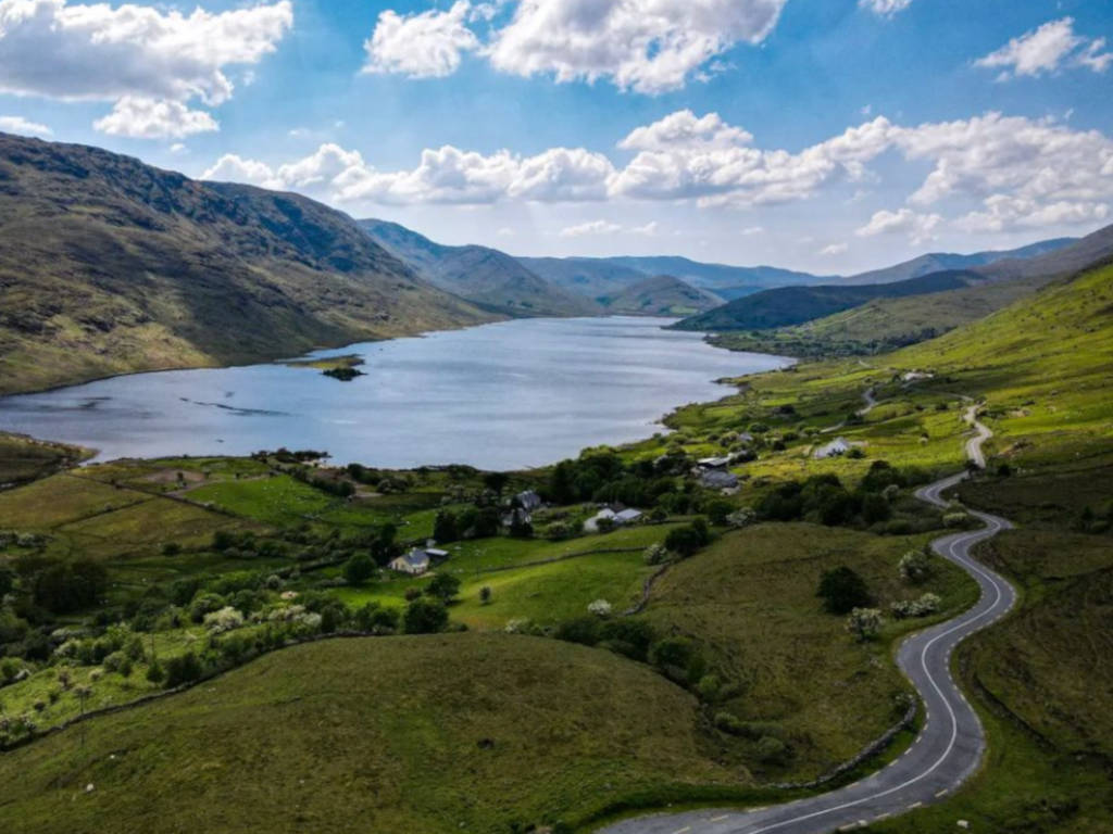
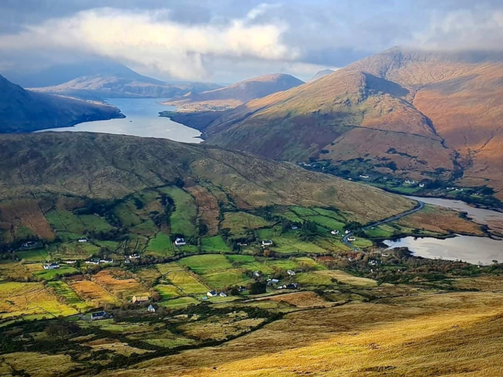
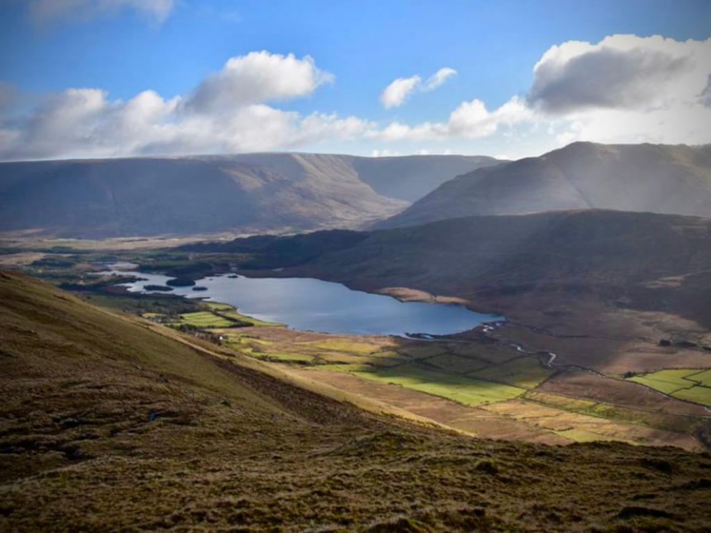
They are located in an area known as Partry, on the borders of County Mayo and County Galway. The mountains stand between Lough Mask (to the northeast), Lough Corrib (southeast), the Maam Valley (southwest) and the River Erriff (northwest). At the heart of the range is beautiful Lough Nafooey.
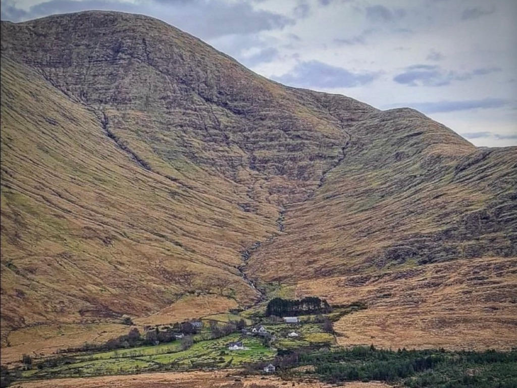
Unlike the serrated peaks of the surrounding mountains, Partry is a plateau, the sides of which have been chomped out by ice erosion. The melting ice has left great deposits of rock debris into which the waterways of the valleys have cut spectacular channels, making them look like miniature versions of large rivers, with gorges, waterfalls, plunge pools and great deposits of rock where the finer material has been washed away.
Partry Mountain Peaks ⛰️
The highest peak in the Partry Mountains is Maumtrasna, which rises to 682 metres (2,238 ft). Other mountains in the range include Devilsmother, Knocklaur, and Bunnacunneen.
| Name | Gaelige | Meaning | Height |
|---|---|---|---|
| Maumtrasna | Mám Trasna | Formnamore (The Great Shoulder) | 682m |
| Devilsmother | Magairlí an Deamhain/Binn Garbh | The Demon’s Testicals/Rough Peak | 645m |
| Knocklaaur | Cnoc Láir | Middle Hill | 518m |
| Bunnacunneen | Binn Uí Chuinneáin | Kinnane’s Peak | 575m |
| Barnahowna | Mám Cam | Crooked Pass | 516m |
| Glennagleragh | An Cnoc Beag | The Little Hill | 617m |
Maumtrasna
Maumtrasna is a monumental sprawl of plateau plunging away in viciously steep slopes and substantial corries around most of its perimeter. The combination of a featureless plateau and very steep ascents makes for a mountain whose exploration requires experience within the party. Great views of Lough Mask, the Sheffries, Mweelrea, and Croagh Patrick.
Devilsmother
Devilsmother is in the Partry Mountains, at the head of Killary Harbour, overlooking the Western Way long-distance path. It sits on the border between County Galway and County Mayo.
The mountain has two Irish language names: Magairlí an Deamhain and Binn Gharbh. The anglicized spellings Mogarlyandoon and Ben Garrif appear on some historical maps. Originally, it seems that Magairlí an Deamhain was the name of a knobbly ridge north of the summit, while Binn Gharbh applied to the mountain as a whole. The English name Devilsmother may be “a euphemistic false translation” or may be based on an alternative name.
Knocklaur
Knocklaur is roughly the midpoint on the ridge connecting Maumtrasna and Devilsmother. This explains its name, Knocklaur, meaning ‘middle hill’. There is a steady bog sweeping up to the summit from the south, while to the north of the summit ridge, the ground plummets away in sharp cliffs and extremely steep slopes.
Bunnacunneen
Bunnacunneen (Bun an Choinin) is part of the Partry/Joyce Country range and reaches an elevation of 575m. It has a full 360-degree view from its summit. The views are stunning on a good day, taking in the whole range of the Maamturks, Ben Gorm, Mweelrea, Devil’s Mother, Maumtrasna, and the Sheefry Hills, as well as Croagh Patrick and the Nephin Beg range. The summit can be identified by a cairn.
Map: Ordnance Survey. Discovery Series. Sheet 38
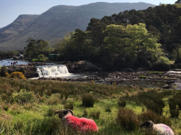
Devilsmother Looped Route (11.3km)
Things to do in the Partry Mountains 🥾
Hiking: The Partry Mountains offer a range of trails, catering to all skill levels from easy to challenging. Enjoy stunning vistas of the surrounding countryside during your hike.
Camping: For those seeking solitude, there are ample opportunities for wild camping in the remote areas of the range, allowing you to savor the tranquility of the mountains.
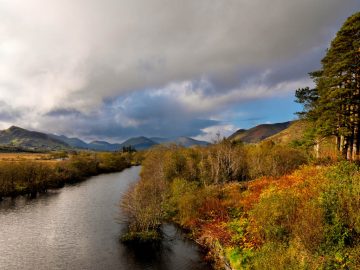
Fishing: Explore the pristine lakes of Lough Mask, Lough Nafooey, and Lough Corrib, along with the River Erriff, featuring the scenic Aasleigh Falls, which provide excellent fishing opportunities. The most common fishing methods in the western Irish lakes involve drifting boats while employing wetfly, dryfly, dapping, or trolling techniques. No fees, licenses, or permits are required for fishing. Lough Corrib teems with Brown Trout, Pike, and Perch. There’s a “bag limit” of four trout per rod per day, and any trout under 13 inches (32 cm) must be released back into the water.
Birdwatching: The Partry Mountains are a haven for diverse birdlife, including common songbirds like meadow pipits, skylarks, stonechats, chaffinches, robins, and wrens. Occasionally, you might spot kestrels and sparrowhawks, with merlins and peregrine falcons making sporadic appearances.
How to get there 🚌🚵
Leenane is the largest village near the Partry Mountains and often a preferred base for hillwalkers. Leenane is at the junction of the R336 Maam Cross Road and the N59 Clifden to Westport Road. Intermittent bus service available (see Bus Éireann Route 419, Galway – Oughterard – Clifden).
Where to eat nearby in Leenane 🍽️
For brunch and lunch The Purple Door Café and the Sheep and Wool Museum Cafe are wonderful for artisan sandwiches, paninis, soups and chowders. For evening meals Leenane Hotel Restaurant and Gaynor’s Bar (The Field Bar) specialise in fresh local seafood dishes as part of their extensive food and drink menus.
Partry Mountains: Best Walking Guides & Maps 🌄 📗
We’ve compiled a list below of the guidebooks detailing the best walking and hiking in the Partry Mountains.
Connemara & Mayo – Mountain, Coastal & Island Walks | A Walking Guide
Walking Directions This handbook lists some of the best and most beautiful places in the Connemara and Mayo region, which is noted for its breathtaking beauty.
OSI Adventure Series | South Mayo
Scaled to 1:25,000, this map is a subset of the Adventure Series by Ordnance Survey Ireland, South Mayo is one of a mini-series of maps for County Mayo.
OSI Discovery Series | Sheet 38 | Part of Galway & Mayo
Galway & Mayo Discovery Series, Sheet 38, Scaled to 1:50,000. The Discovery & Discoverer Series is a collection of 93 maps that covers the entire island of Ireland and is available in Standard or Laminate finish.
Connemara, West Galway and South Mayo
The scale compresses between the foreground and the horizon, so a variable scale is printed around the edges of Richard Chandler’s original hand-painted artworks from the Fir Tree Series of Aerial Maps, which capture a true birds-eye view from an oblique angle.